
How accurate are crop scouting apps in low-connectivity fields?
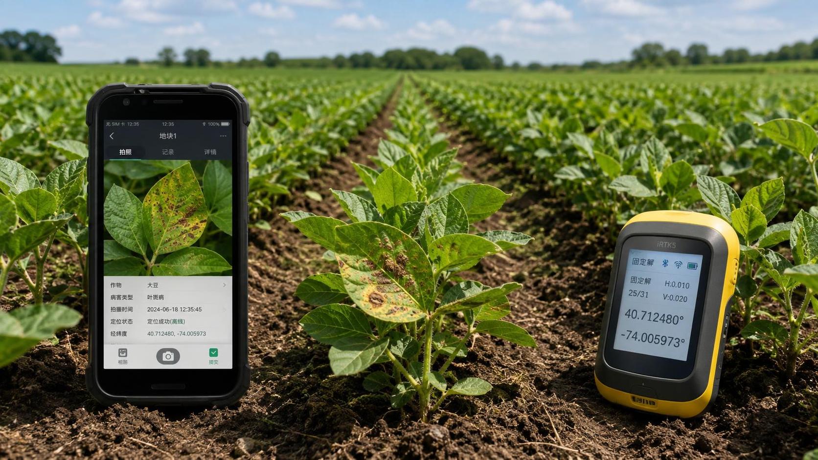
Crop scouting apps can be accurate in low-connectivity fields, provided that the field record is treated as an offline observation first and a cloud record second. Lack of cellular service does not inherently weaken a photographed symptom, a manually placed pin, or a GPS track. Accuracy declines when the application requires live map tiles, server-side image analysis, online boundary lookup, or immediate synchronization before it can preserve the observation.
The practical test is whether a scout can enter a field with no signal, capture a location, attach usable images and notes, follow a planned route, and later transfer the full record without changing its time, coordinates, attachments, or field association. An app that merely stores a draft note offline is not equivalent to one that supports dependable offline scouting.
Accuracy has several separate components
A crop scouting record is often described as accurate or inaccurate as though it were a single property. It is more useful to separate positional accuracy, observation accuracy, field-context accuracy, and synchronization integrity. A record may have excellent coordinates while identifying the wrong disease. It may correctly describe insect feeding but appear in the wrong management zone after a boundary update. Low connectivity affects these components differently.
Satellite positioning is often misunderstood in this setting. A phone does not need mobile coverage to calculate a basic GNSS position; it needs a clear enough view of satellites. Mobile networks can assist with faster initial positioning and may distribute correction data, but they are not the source of the satellite fix itself. Field edges beside tree lines, steep terrain, metal grain bins, irrigation structures, and dense canopy can matter more than the absence of cellular service.
That distinction matters when observations will later guide spot spraying, tissue sampling, replant decisions, or drainage investigation. A broad pest hotspot can tolerate a modestly uncertain pin. A narrow weed patch beside a waterway, a suspected herbicide overlap, or a plant sample tied to a precise grid location requires much stronger location discipline.
Offline maps determine whether a pin means anything
Coordinates alone are insufficient. The app must retain enough local context to show where the point sits within the correct field. Before leaving connectivity, field polygons, farm names, access roads, management zones, and relevant layers should be downloaded to the device. If imagery is part of the route plan, the required zoom levels must also be available locally. A cached overview image that becomes blank when zoomed in is of limited value when walking irregular field margins.
Boundary versioning deserves attention. Farms change rented acres, split fields, merge management units, and adjust headlands. If the offline device holds an older polygon while the central system has a newer one, a point near the edge can be assigned differently after upload. This is not a GPS failure. It is a data-governance issue that can make a valid field observation appear misplaced.
Applications should preserve the captured latitude and longitude, the locally selected field, the boundary version available at capture, and the later server-side association. Keeping these elements distinct allows a reviewer to see whether a conflict arose from positioning or from a changed map. Systems that silently snap a point to a new field polygon can conceal an important discrepancy.
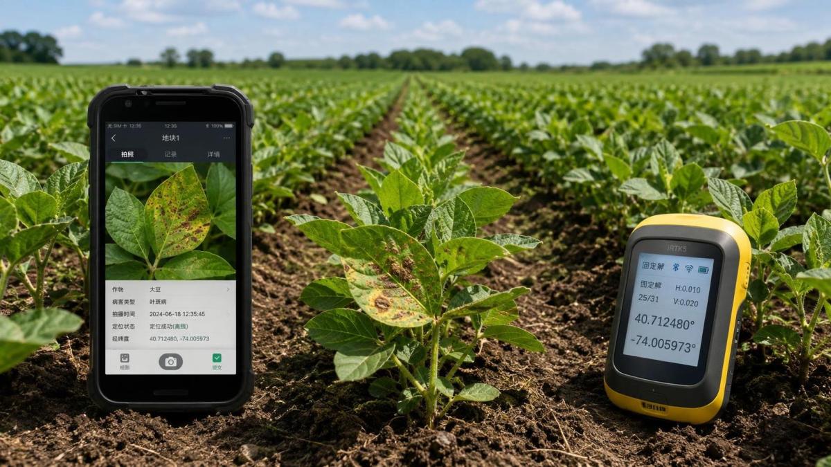
Image quality usually limits diagnosis before connectivity does
Low-connectivity workflows frequently rely more heavily on photographs because remote agronomic review will occur later. That makes image capture discipline central to the accuracy of the eventual assessment. A single close-up of a damaged leaf rarely distinguishes nutrient deficiency, disease lesion, insect feeding, chemical injury, and environmental stress. Several unrelated conditions can produce chlorosis, necrosis, curling, stunting, or uneven color.
A useful observation set shows the symptom at more than one scale: the affected plant or plant group, the surrounding row section, and a close image of the relevant tissue, pest, lesion, stem, root, or canopy feature. The capture should include both symptomatic and apparently normal plants from nearby when comparison is meaningful. Images taken against direct glare, through dust-coated lenses, or after digital zoom can create false texture and color shifts that no later cloud analysis can correct.
Timing also changes what an image represents. Leaf rolling at midday, dew on foliage, temporary wilting after irrigation interruption, spray droplets, and soil splash can all complicate interpretation. A note that records crop stage, recent rainfall or irrigation, prior application timing, and symptom distribution often provides more diagnostic value than an automated label generated after upload.
Offline image recognition needs separate scrutiny. Some applications package a model on the device; others capture the image locally but send it to a server for classification once a connection returns. The first approach can produce an immediate result without coverage, but the installed model may be large, out of date, or limited to a narrow crop and symptom set. The second approach can use a more current model and broader reference library, but it offers no reliable diagnostic output during the field visit. Neither architecture removes the need for agronomic validation when symptoms overlap.
GPS precision should match the action that follows
Basic consumer-device GNSS is often sufficient for documenting a general issue area, establishing a repeatable scouting route, or returning to a clearly visible patch. It is less suitable when the point will become a machine task line or a tightly bounded treatment instruction. Positional error is not constant: it changes with satellite geometry, atmospheric conditions, device antenna design, time under canopy, and whether the device is held upright, carried in a pocket, or mounted in a vehicle.
RTK guidance on a tractor or sprayer should not be assumed to transfer its precision to a scouting phone. The two devices may use different receivers, correction methods, coordinate settings, and data paths. A crop scout can record a credible location that is adequate for inspection while still being unsuitable as a direct target for centimeter-level equipment guidance.
Where a finding needs to feed a variable-rate map or a targeted pass, the workflow should explicitly state the intended spatial tolerance. A mapped aphid infestation across several passes of a boom requires an area boundary or a sequence of points, not one pin at the entry location. A tile-outlet problem may need a point plus photographs oriented toward the drainage feature. A suspected skip in planted rows is better recorded with a short track or polygon that expresses its length and direction.
Collecting repeated positions is a practical way to expose unstable reception. If successive points taken while standing at the same plant drift visibly across the offline map, the record should describe the feature broadly rather than claim a precise center. Some applications display estimated horizontal accuracy, but that figure should be interpreted as a positioning quality indicator, not a guarantee that the mapped issue boundary is equally accurate.
Synchronization is a controlled handoff, not a background detail
The riskiest moment in a low-connectivity workflow is often the return to coverage. Large image files may upload after text notes; a device can switch between weak cellular service and Wi-Fi; an application may close before its queue completes; and edited observations can conflict with a version already visible elsewhere. A green status icon is useful only when it refers to every component of the observation rather than the note alone.
Records should retain local timestamps and upload timestamps. The difference matters when an agronomist reviews a rapidly changing disease situation or when a treatment decision depends on whether symptoms were seen before or after an application. Photo creation time should remain linked to the observation even if images are compressed or uploaded later.
Offline-first systems are stronger when they show a clear pending count, identify failed attachments, prevent accidental deletion of unsynchronized records, and allow a record to be reopened after upload without creating ambiguous duplicates. Duplicate detection must be cautious. Two nearby observations made on the same day may represent repeat evidence of a spreading condition, not a redundant entry.
Field teams also need a defined approach to edits. Reclassifying a symptom after laboratory results or specialist review is legitimate, but the original field note should remain traceable. Replacing “suspected disease” with a confirmed diagnosis without retaining the basis of the revision weakens later analysis. The same principle applies to severity scores, pest counts, and area estimates.
Scouting routes expose hidden weaknesses
An app can appear reliable in a short demonstration while failing during a full day across disconnected acreage. Route execution tests should include entering and leaving coverage, switching fields, capturing multiple photos per point, recording voice notes, pausing the application, restarting the device, and completing synchronization over an ordinary connection. The objective is to find whether data remain coherent after realistic interruptions.
Route design also affects biological accuracy. A convenient road-edge path may repeatedly miss compaction zones, low-lying disease pressure, irrigation variation, planter issues, or localized weed escapes. Digital route guidance is valuable when offline basemaps and planned sampling points are already stored, yet the app cannot correct a sampling design that ignores field variability.
Grid-based observations, zone-based walks, and exception scouting answer different questions. A grid supports comparable measurement across a field but may be slow and may miss a rapidly developing patch between points. A management-zone route connects scouting to soil, elevation, yield, or irrigation differences, provided those layers are current offline. Exception scouting is efficient after drone imagery, satellite imagery, or a machine alert identifies an anomaly, but it requires confirmation that the anomaly is real rather than a shadow, sensor artifact, or stale imagery.
Validation should follow the management consequence
Not every observation needs the same evidence threshold. A note that prompts a return visit can tolerate uncertainty. A record intended to justify pesticide selection, modify fertilizer rates, change irrigation scheduling, or command an autonomous or precision application workflow needs corroboration. That may include plant counts, row-length measurements, leaf samples, soil moisture readings, trap records, machine logs, or comparison with recent field operations.
Severity scales should be defined before records are compared across fields or dates. A label such as “moderate” is vulnerable to personal interpretation unless it is attached to a consistent measure: proportion of plants affected, lesion coverage, plants per defined row length, weed density class, or another observable criterion. Offline operation does not prevent standardization, but the scoring guidance and reference images must be available on the device.
False precision is a recurring problem. A pin placed over a colorful vegetation index layer can look exact even when the layer was collected on a different date, the phone location has drifted, and the symptom extends well beyond the point. The visual confidence of a map should never be mistaken for evidence that the diagnosis, boundary, or treatment area has been verified.
Reliable crop scouting in disconnected fields comes from a complete local record: current offline maps, stable coordinate capture, images with agronomic context, explicit observation methods, and an auditable synchronization process. Connectivity mainly determines when shared analysis becomes available. The field record remains trustworthy when its essential evidence survives the period without a network.
Related Intelligence